Nueva Guinea (Nueva Guinea)
 |
Nueva Guinea was founded in the 1960s and saw significant growth in the early 1970s as the US Peace Corps helped to move families from the Pacific region of Nicaragua to Nueva Guinea in exchange for free land and agricultural help.
20 km east of Leon Nicaragua, Cerro Negro erupted on 3 February 1971, causing extensive ash fall to the west. Up to 10 cm of ash were deposited in villages near the volcano. The eruption ended on 14 February. Much farmland was damaged by the ash fall from the eruption. USAID and/or perhaps U.S. Peace Corps, in conjunction with the Government of Nicaragua, provided aid consisting of elements of the U.S. Air Force 24th Special Operations Squadron, Howard Air Force Base, Canal Zone (Panama). In an effort encompassing approximately 3 weeks in early 1971, U.S.A.F. C123K aircraft conducted numerous sorties between Leon Nicaragua and Nueva Guinea relocating an estimated 1000 families along with their livestock and pets to Nueva Guinea. Helping to coordinate the weeks-long relief effort were 2 U.S.A.F. combat controllers on site throughout at Nueva Guinea. The two controllers provided radio communications, set up and maintained a non directional beacon navigation aid, provided weather observations and updated airfield status reports helping to ensure safe air operations.
Skilled pilots landed the high-wing C123s on the unimproved runway surface at Nueva Guinea onto a sod runway surface not much wider than the fuselage and landing gear of the large aircraft. The high wings extended over meter high berms along each side of the runway. Part way into the mission, a bulldozer was airlanded by the C123K aircraft. The bulldozer was used to extend the runway and over-run area and some levelling of the berms along the runway length was accomplished. This was done in order to increase runway safety.
During the weeks-long mission, the on site air force controllers were joined each day alongside the runway by several of the local children ages from about two years to perhaps 14 years who watched the goings-on and were delightful companions to the two working controllers.
The disaster response relocation of Nicaraguan citizens was of a magnitude (estimated 1000 families) that was at the time quite significant to the Nueva Guinea community. It is believed at that time (1971) that Nueva Guinea lacked all-weather road connections. The road connecting to populated regions of Nicaragua was only believed passable during the dry season. In 1971 there was a medium size electric generator in the town that operated for several hours nightly, powering some street lights and perhaps a few basic shops and homes. Refrigeration was accomplished with "ice boxes" and ice, packed in burlap bags with sawdust for insulation was flown in regularly. It is believed that two local bakers alternated bread making duties for the townspeople and fresh beef or pork was available- usually one or the other- depending upon the butchering schedule. As chickens seemed numerous, eggs were readily available at the small restaurant in town. At the time of the air mission, in addition to the two USAF personnel in town there was one U.S. citizen known to reside longer-term in Nueva Guinea, that being a Catholic aid worker from Sheboygan, Wisconsin USA. (Written by a USAF combat controller who lived at Nueva Guinea throughout the relief mission in 1971.)
The municipality shares borders to the north with the municipalities of Bullocks Wharf and El Rama; to the south with San Carlos, El Castillo and Bluefields; to the east with El Rama and Bluefields; and to the west with those of El Almendro, Villa Sandino and San Miguelito.
The county seat is located 292 km from the city of Managua.
The town is divided about halfway through the mountains of the Cordillera de Yolaina.
Map - Nueva Guinea (Nueva Guinea)
Map
Country - Nicaragua
 |
 |
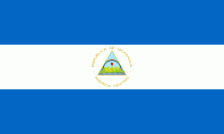
| Flag of Nicaragua | |
Originally inhabited by various indigenous cultures since ancient times, the region was conquered by the Spanish Empire in the 16th century. Nicaragua gained independence from Spain in 1821. The Mosquito Coast followed a different historical path, being colonized by the English in the 17th century and later coming under British rule. It became an autonomous territory of Nicaragua in 1860 and its northernmost part was transferred to Honduras in 1960. Since its independence, Nicaragua has undergone periods of political unrest, dictatorship, occupation and fiscal crisis, including the Nicaraguan Revolution of the 1960s and 1970s and the Contra War of the 1980s.
Currency / Language
| ISO | Currency | Symbol | Significant figures |
|---|---|---|---|
| NIO | Nicaraguan córdoba | C$ | 2 |
| ISO | Language |
|---|---|
| EN | English language |
| ES | Spanish language |


